Shanghai IMa Technology (MAXIEYE) announced today that its new generation of intelligent driving system product, MAXIPILOT, has successfully deployed the NOM (Navigate on MAXIPILOT) navigation assisted driving system.
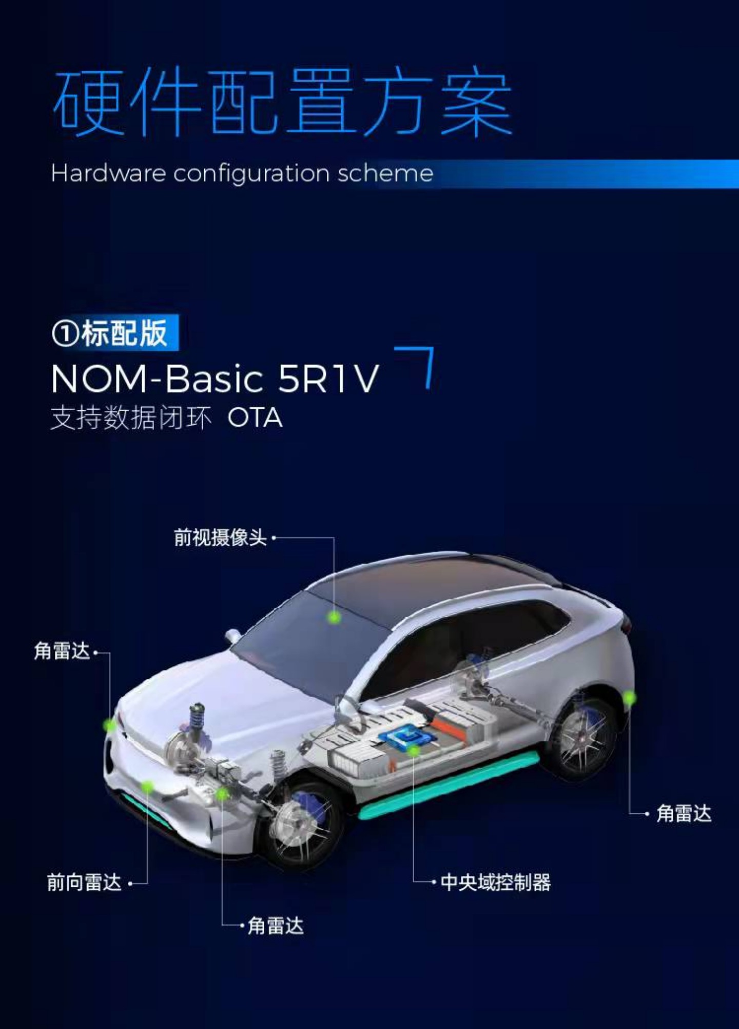
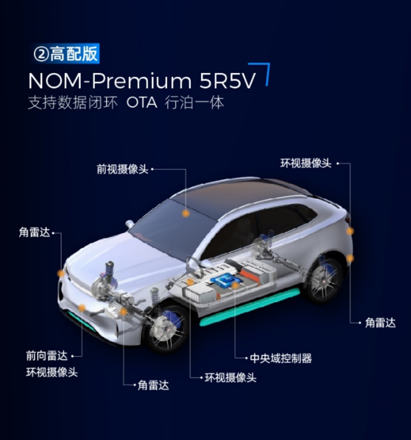
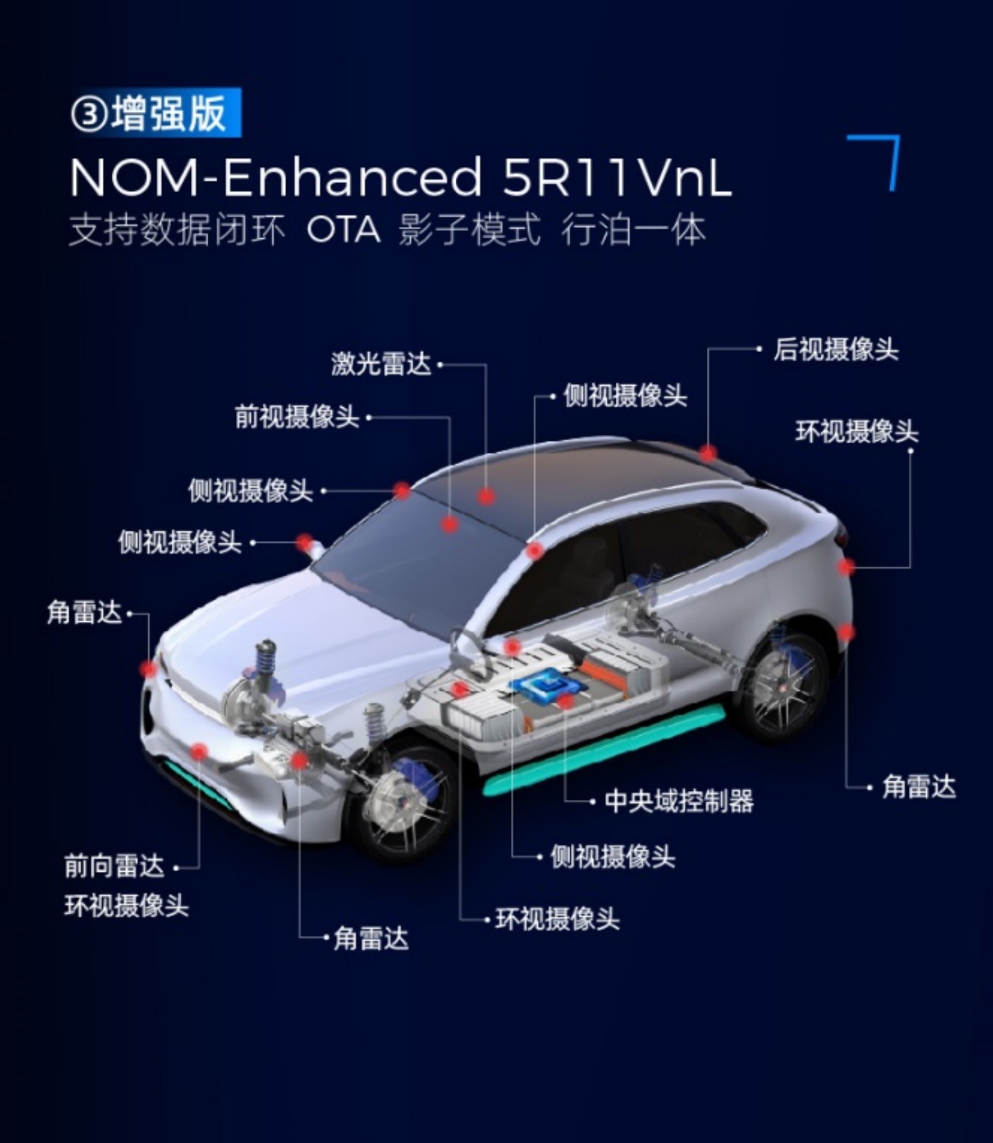
The new feature will include three versions: basic, high-end, and enhanced, matching different computing platforms and sensor configurations to achieve “point-to-point” intelligent driving.

The basic version of NOM is built on one camera and five millimeter-wave radar sensors, achieving 360-degree perception coverage. The system also incorporates high-precision map navigation and positioning technology, which can independently complete intelligent path planning in high-speed scenarios, automatically enter and exit ramps, switch to main roads, automatically adjust vehicle speed based on road speed limits and working conditions, automatically change lanes, automatically overtake, and safe avoidance of large vehicles.

The high-end NOM will be built on five cameras and five millimeter-wave radar sensors, with a higher computing platform, and will achieve highly-integrated travel and parking solutions. In addition, the high-end NOM in the driving area will also integrate four surround-view cameras to reduce take-over rates.

The enhanced version of NOM will be based on the configuration of five millimeter-wave radar sensors, 11 cameras, and laser radar (the number has not been announced), to expand the boundary of “point-to-point” automatic driving system and achieve L3 and other high-level intelligent driving functions.
MAXIEYE said that the most significant innovation of NOM is that it takes a human-like driving perspective and effectively solves planning problems in scenarios such as map/positioning loss and target information occlusion through FPP (fusion path planning), improving system robustness.
When there is deviation between map positioning and system perception, the system will generate a local topology map through visual perception, compare the topology maps provided by high-precision maps or navigation maps with the topology map perceived by itself, and provide a “local optimal solution” for the vehicle’s driving path.
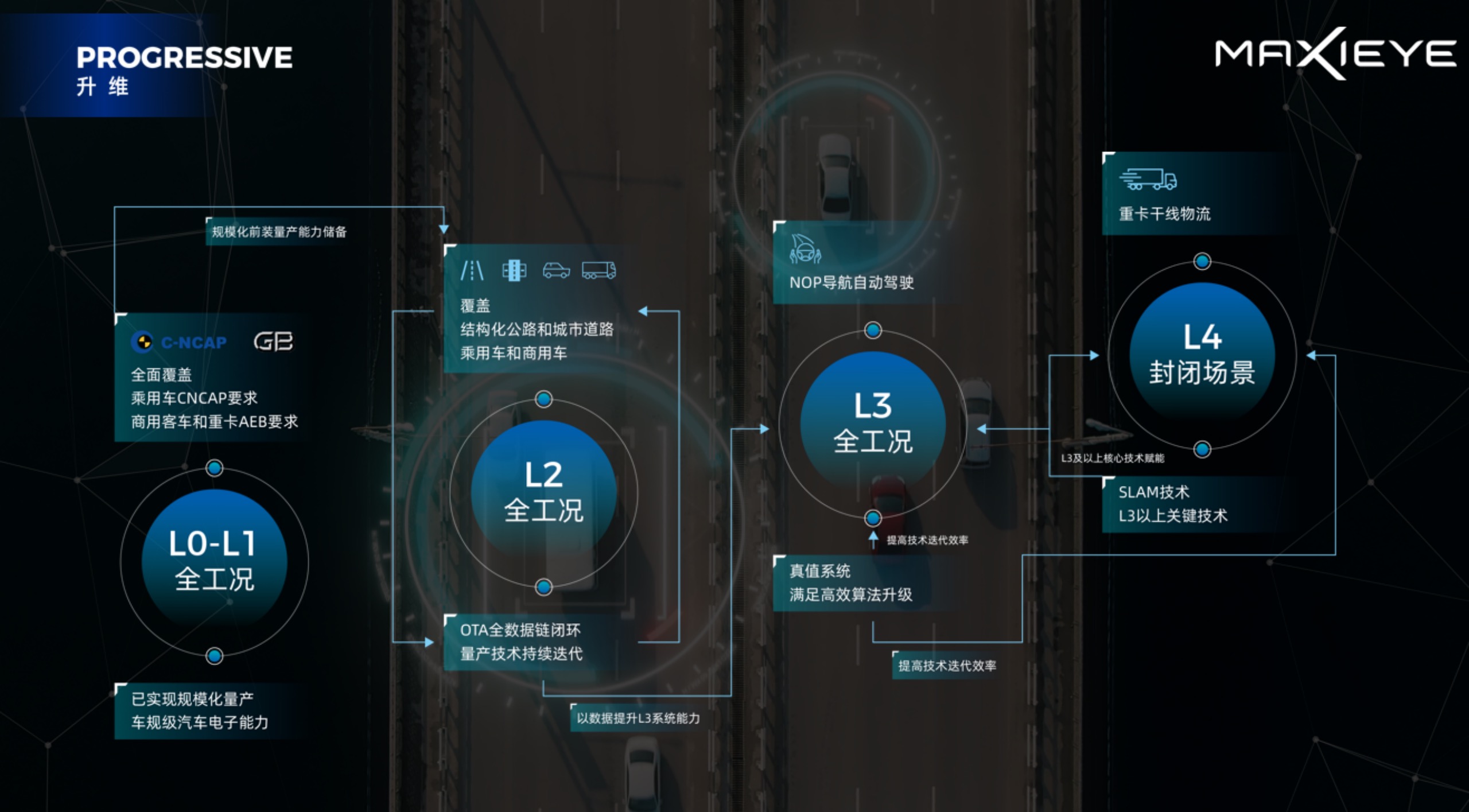
The product depends on technological progress, but so far there is no news on car companies installing MAXIEYE NOM as standard equipment. In the future, MAXIEYE will continue to use data to achieve algorithmic self-enhancement, accelerating technological evolution and product iteration speed.
This article is a translation by ChatGPT of a Chinese report from 42HOW. If you have any questions about it, please email bd@42how.com.
