Author: Michelin
As we approach the end of 2021, if we were to identify two of the fastest progressing and most potent features within car cabins, one would be voice commands, and the other would arguably be navigation.
To encourage customers to ditch their mobile navigation devices and opt for in-car systems, automakers have gone to great lengths. On the one hand, they’re providing experiences that phone apps simply can’t match, such as seamlessly integrating navigation with speech-recognition technology. This allows for visible, spoken instructions along with multi-round voice interactions. They’re also combining navigation with vehicle information, displaying remaining mileage and showing proprietary charging stations during routing. On the other hand, carmakers are also racing to incorporate high-precision maps to enable more precise lane-level navigation.
Earlier in the year, Amap launched its third-generation navigation system that integrated high-precision maps into in-car navigation, and on November 4th, at Tencent’s Global Digital Ecosystem Conference, a smart driving map was introduced for human-vehicle joint driving. It’s an impressive fusion of three separate maps – high-precision maps, ADAS maps, and standard navigation maps – offering lane-level navigation as a comprehensive, one-stop-shop solution.
So, what unique experiences can high-precision maps bring us? And is “all-in-one” the best map solution for everyone?
In the Age of Human-Vehicle Joint Driving, the Shift from “Guiding People” to “Joint Navigation” Has Emerged
When drivers are behind the wheel, whether they use mobile apps or in-car maps, they’re the targeted service objects. A map shows the network shape, topology, and even some rule limitations with lines, guiding drivers along the way using images and sound, with an accuracy of 5-10 meters.
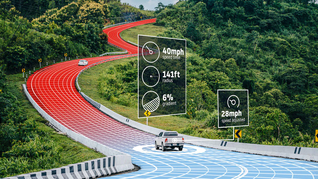
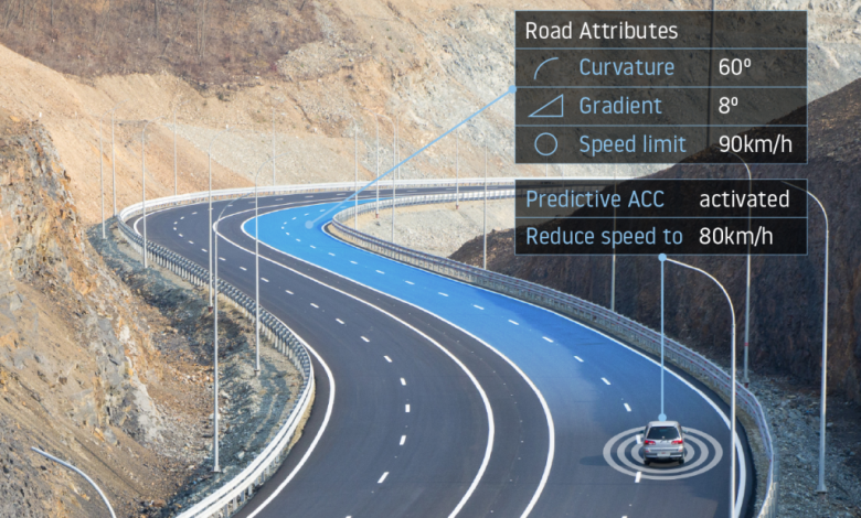
However, this navigation approach is not suitable for machines. High-precision maps are needed for vehicles operating in autonomous driving mode or those with ADAS capabilities. In addition to the road topology of a traditional navigation map, the vehicle system also requires more detailed parameters such as road gradient, curvature, traffic signals, parking space availability etc. with absolute accuracy reaching sub-meter precision. High-precision maps operate as special “guidebooks” for machines that help them recognize road conditions beyond the line of sight and compensate for insufficient on-board sensors.
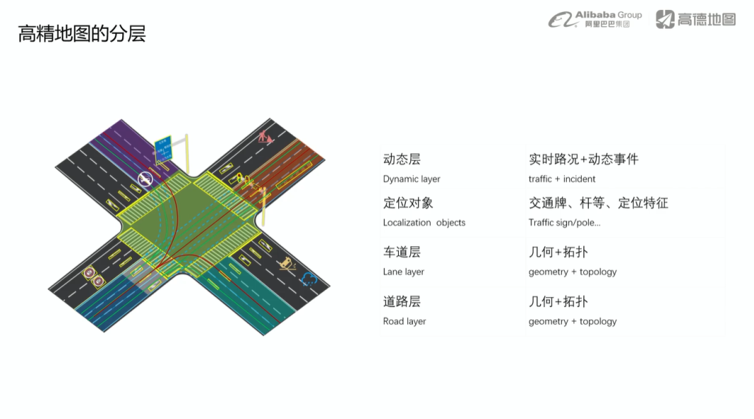
In between these two mapping methods is the ADAS map, which contains relative position information such as road gradient and curvature, but not absolute position information. This information is used in ADAS driver assistance functions and has an accuracy of 20-50 cm.
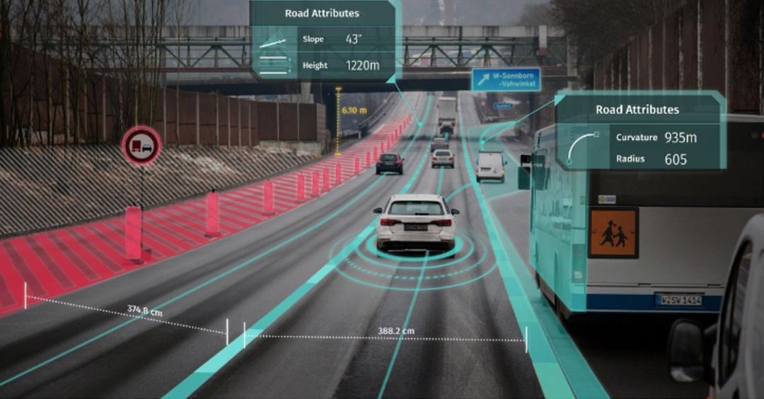 With the development of intelligent automobiles, we have been able to experience more and more assisted driving functions. In scenarios such as highways and parking lots, we can experience autonomous driving. Common situations encountered while driving require frequent switching between the driver’s driving, assisted driving system working, and driver takeover. Correspondingly, navigation is required to be provided to both the driver through regular maps and to the autonomous driving system through ADAS and high-precision maps. This means that maps during the period of human-machine collaboration not only need to provide navigation for humans but also need to facilitate “human-vehicle collaboration”.
How to make the seamless switching and data fusion of independent navigation maps, ADAS maps, and high-precision maps become the pursuit of map suppliers and directly impact the user experience.
In the original vehicle architecture, common navigation maps and high-precision maps are independent of each other and belong to different domains, namely the entertainment domain and the autonomous driving domain. They have different product plans and different data demands and update frequencies.
AMAP’s third-generation navigation system achieves “human-vehicle collaboration” by seamlessly switching between common navigation maps and high-precision maps. Baidu Map blends high-precision maps, high-precision positioning, and regular maps to ensure smooth switching. Tencent produces high-precision maps, ADAS maps, and regular navigation maps based on a high standard of basic data on this unified data basis according to different specifications and requirements, thereby solving the consistency problems in data from the source and achieving “integration of three maps.”
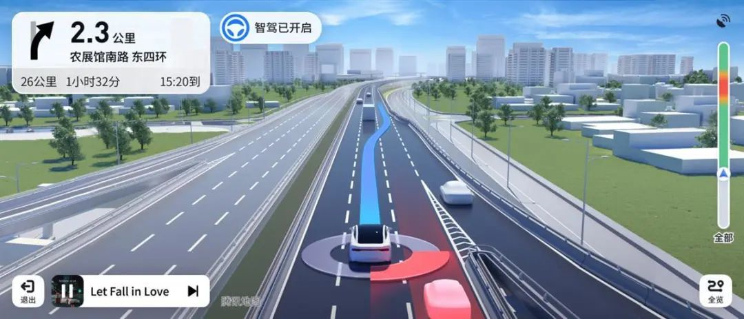
Of course, although Tencent’s “integration of three maps” is based on the same basic data, the update frequency of high-precision maps and regular maps is different. How to deal with conflicts when the data of the two clash, whether the OEM’s original R&D system matches the “integration of three maps” mode, and whether there are enough sensors to support environmental perception and intelligent data may also be problems that need to be faced in the future.
What different experience can the fusion of high-precision maps bring us?
As the “eyes” of autonomous driving, high-precision maps help it perceive long-distance road conditions and make up for the shortcomings of on-board sensors, making them a catalyst for achieving autonomous driving. In both NIO’s NOP using Baidu’s high-precision maps and Xpeng’s P7 using AMAP’s high-precision maps, specific sections of autonomous driving functions are achieved through seamless switching between regular maps and high-precision maps, and lane-level navigation makes navigation more accurate. The networked capabilities of high-precision maps can to some extent make up for the inadequacies of on-board sensors and indirectly lower the threshold and hardware costs of single-car intelligence.
 What about other aspects of intelligent experience besides autonomous driving?
Firstly, in terms of visual presentation, visualization plays a connecting role. As a machine map, whether it is a high-precision map or an ADAS map, it may appear as a point cloud or a dense array of parameters, which does not have user-readable attributes. However, after the high-precision map is loaded, whether it is Baidu, Gaode, or Tencent, they all present the information provided by the high-precision map and ADAS map in a visual form on the navigation interface, which not only lets the driver know what the car is seeing, but also what the car is thinking, and this visualization helps to establish trust between the driver and the system.
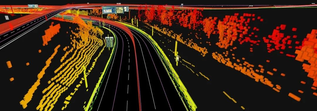
In addition, the integration of high-precision maps and ordinary maps connects the autonomous driving domain with the information and entertainment domain, and the navigation information, long-range information, and dynamic traffic information from the information and entertainment domain all need to be transmitted to the autonomous driving domain for real-time path planning to ensure a better intelligent driving experience. The feature of real-time refreshing of high-precision map data can also improve the level of the current location-based service (LBS) function in map navigation.
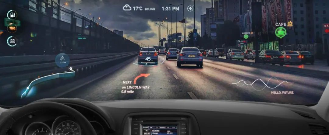
For example, in showcasing AR-HUD functionality, there is often a scene where not only basic information such as vehicle speed and turn guidance are displayed in front of the driver, but also information about parking lots, restaurants, and cafes around the road is projected. The high refresh rate of high-precision maps may further enhance this feature, displaying the number of parking spaces in real time while guiding to the parking lot or showing the number of people waiting at restaurants. Of course, these all depend on the completion of driving safety and infrastructure internet connection functions.
Business models behind high-precision maps
When high-precision maps are integrated with ordinary maps, the result is not only more precise lane-level navigation and visual auxiliary driving effects, but also new imagination space for high-precision map business models.
High-precision maps are an industry with high research and development costs, and short-term revenue is not clear. As one of the leading companies in China’s high-precision map industry, Navinfo invests more than 50% of its R&D funds in high-precision maps, which increases its investment in data collection, frequent updates, and maintenance. Conversely, while there is high investment, there are also newcomers like Amap who have called for “free” and only charge an annual fee of 100 yuan per vehicle at cost price.
 Although many people regard high-precision maps as the infrastructure of the industry rather than a profitable tool, it is still important to explore the new business models it may bring. For example, as mentioned earlier, the LBS function is integrating map navigation with commerce. Tencent’s smart driving map also integrates navigation with its own WeChat frictionless payment, allowing vehicles to both utilize the map for automatic parking in supported facilities and utilize frictionless payment when automatically driving out to pay for parking fees.
Even Mercedes-Benz has customized maps from Gaode (AutoNavi), will they incorporate high-precision maps in the future?
Conclusion
As smart cars develop, we see changes in in-car maps: from 2D plane navigation to 3D. In addition, previously solitary offline maps have evolved to become connected and capable of interacting with in-car voice and vehicle control functions. Nowadays, the introduction of high-precision maps has brought changes to the functions and objects of maps.
The high research and development costs and iterative costs of high-precision maps inevitably lead to a winner-takes-all scenario. Therefore, as each company accelerates the integration of high-precision maps and the landing of automated driving, we expect it to bring different experiences.
This article is a translation by ChatGPT of a Chinese report from 42HOW. If you have any questions about it, please email bd@42how.com.
